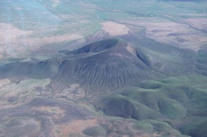
 I departed Santa Teresa early with a final destination of Payson, AZ. The scenery along the first part of the route was unlike anything I had seen before. I heard another pilot who departed after me say on the radio that he was west bound towards the Black Hills. I guess this is what he was talking about. There were dozens of them and they look like they may be old volcanoes. The soil is black but due to an unusually rainy summer there is vegetation greening them up a little.
 Some places were totally green and in some places the vegetation was only present in the areas that are lower. There were also lots of mountains along the way.
 I flew for about two and a half hours and landed in Safford, AZ for fuel and to stretch my legs. The place was pretty desolate. Apparently it is used extensively for aerial fire fighting operations when there are fires nearby. Being there were none in the area there was little activity.
 My major concern was thunderstorms that form around mid-day in the mountains north of Phoenix. Which is right where I was headed. This little storm was about 80 miles from Payson but it was a taste of things to come. I had emailed ahead to let them know I was coming and wanted to stay at the airport campground. When I checked my email at Stafford I was assured that getting a spot would be no problem as there was only one airplane at the campground. Ray, the airport coordinator also warned me about afternoon thunderstorms in his email.
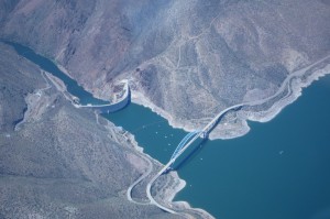
 As I approached Payson, I flew over the Roosevelt Reservoir as I followed the valley up into the mountains. Up ahead I could see a pretty impressive line of storms. They form as the air rises over the ridge a few miles north of Payson.
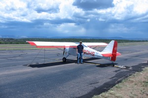
 I landed in a gusty crosswind with the storms only a few miles away and Ray came out and helped me tie Niner-Zero down. Then he took this picture and you can see the rain falling over the ridge to the north and some ominous clouds working their way south towards the airport. Ray was about to take his lunch break and he dropped me off at a grocery store on the way and picked me up on the way back. Allowing me to cook a really good dinner.
 I was able to get my tent up after I returned and just before it started to rain. I was not so lucky later when I was cooking dinner. It started raining again and I had to move my dinner under cover.
 The next day I took advantage of the compass rose st the airport to realign my EFIS and then did a little flying to test the new settings and just get a feel for how Niner-Zero performs at a density altitude of 7,000 ft. Then I got her fueled up in preparation for an early morning departure the next day. I took a hike on some nearby US Forest Service trails and got back just before it some storms moved through.
